 ©UNHCR/Adam Dean
Data For Good
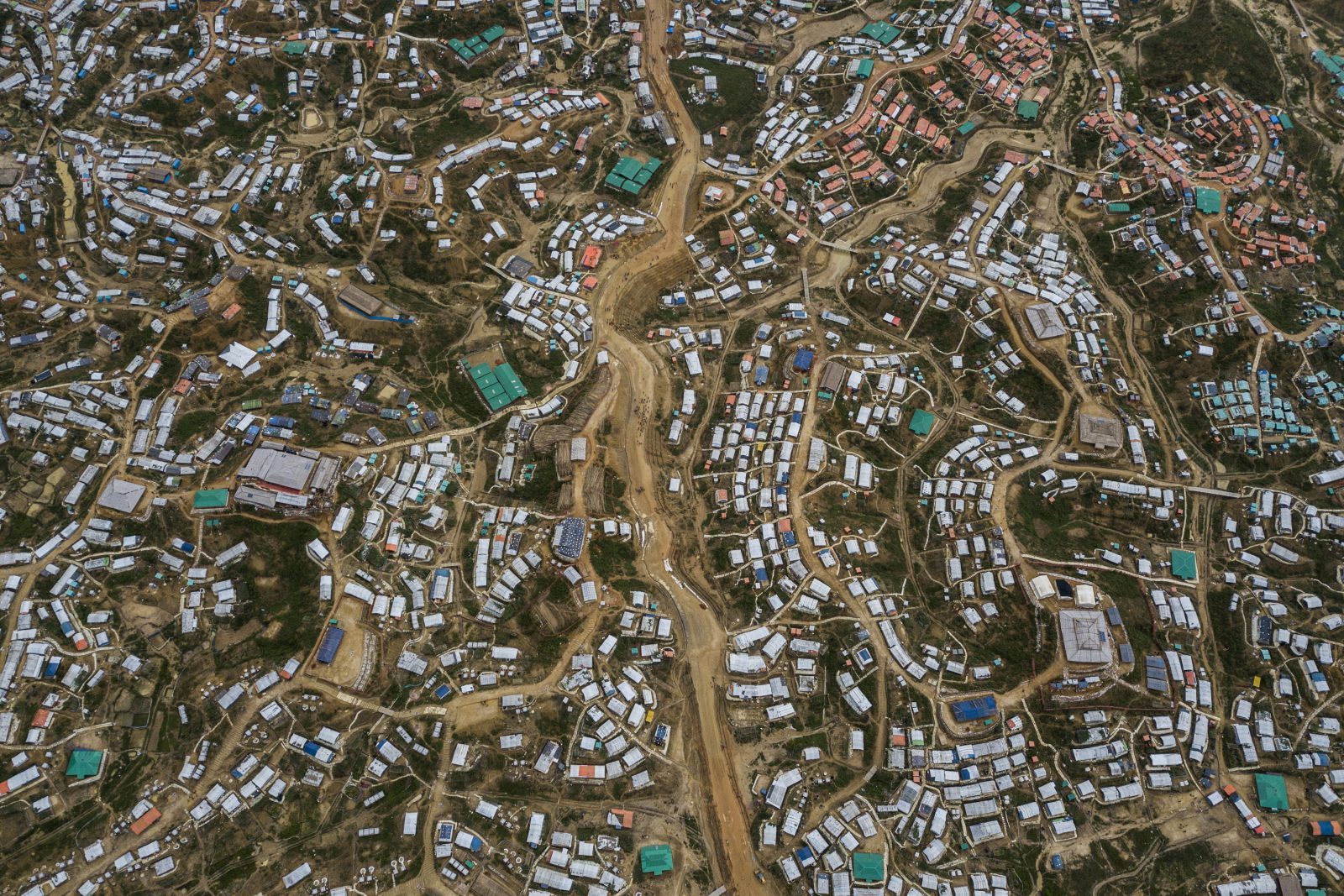
When crisis hits, UNHCR is on the ground within hours to set up emergency shelter and provide other emergency support. However, without understanding the full impact of a fleeing population, camp planning can be challenging, and camps can quickly become overcrowded and congested. Currently, one of the ways UNHCR manages this is through manual mapping of geospatial data, but this manual mapping effort takes a lot of staff time and effort, and as these crises unfold, the manual data changes.
To respond to this need, the USA for UNHCR data team – the Hive – embarked on a massive automated data mapping effort. In partnership with UNHCR Site Planning, UNOSAT, UN OCHA’s Center of Humanitarian Data, Digital Globe and Stanford’s Sustainability and AI Lab, the Hive used geographic information systems (GIS) data to map over 10,000 square kilometers of UNHCR Camps in Western Asia, Southeast Asia and Africa. Stanford achieved over 85 percent precision and accuracy in identifying tent structures. This could allow UNHCR Site Planning to have more accurate understanding of real time camp populations, in order to best serve emerging needs on the ground.